Spreadsheet to Map
Create a Custom Google Map from a CSV Spreadsheet
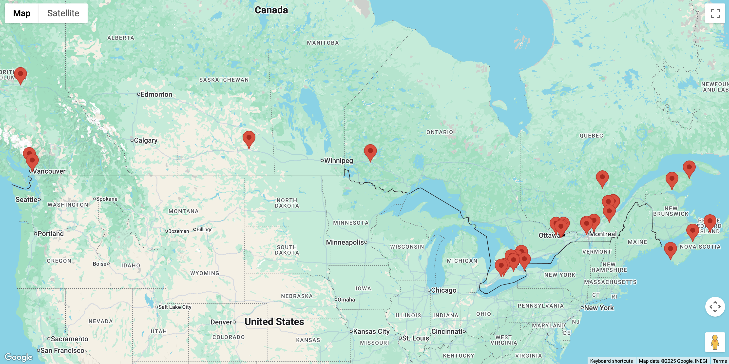
This is a simple tool that allows you to upload CSV or Excel spreadsheets with location data to generate a map with multiple locations.

Tutorial
This tool turns a small spreadsheet into a Google Map with markers and optional popups.
1. Upload your spreadsheet
- Click Select a File.
- Supported formats: CSV, XLSX, XLS.
- The first row must be column names (headers).
- Maximum: 50 data rows.
- If your file is larger, you’ll see an error and a link to the advanced Atlist tool.
If the file is valid, you’ll be taken to Step 2.
2. Choose location columns
You’ll see a list of your columns, each with a preview of the first value.
- Under “Select all the column(s) that contain location data:”, check every column that helps define the location.
- For addresses, this might be Street, City, Postal Code, etc.
- For lat/long, this might be Latitude and Longitude.
- Under “What type of location data do these column(s) contain?”, pick:
- Addresses – if your data is text addresses (e.g. “123 Main St Toronto ON”).
- Latitude and Longitude – if you already have numeric coordinates.
3. Choose popup columns
Decide what shows when someone clicks a marker.
- Check any columns you want in the marker popup (e.g. Name, Description, Phone).
- Leave everything unchecked if you don’t want popups at all.
4. View your map
- The tool creates a marker for each row that has a valid location:
- For lat/long, it uses the selected coordinate columns.
- For addresses, it uses geocoding with the combined address datausing Google Maps.
- The map automatically zooms to fit all markers.
- If you selected popup columns, clicking a marker will show them in an info window.
You’ll also see links to advanced Atlist tools if you need more rows or features (like polygons or more styling).
Export Google Sheets Spreadsheets
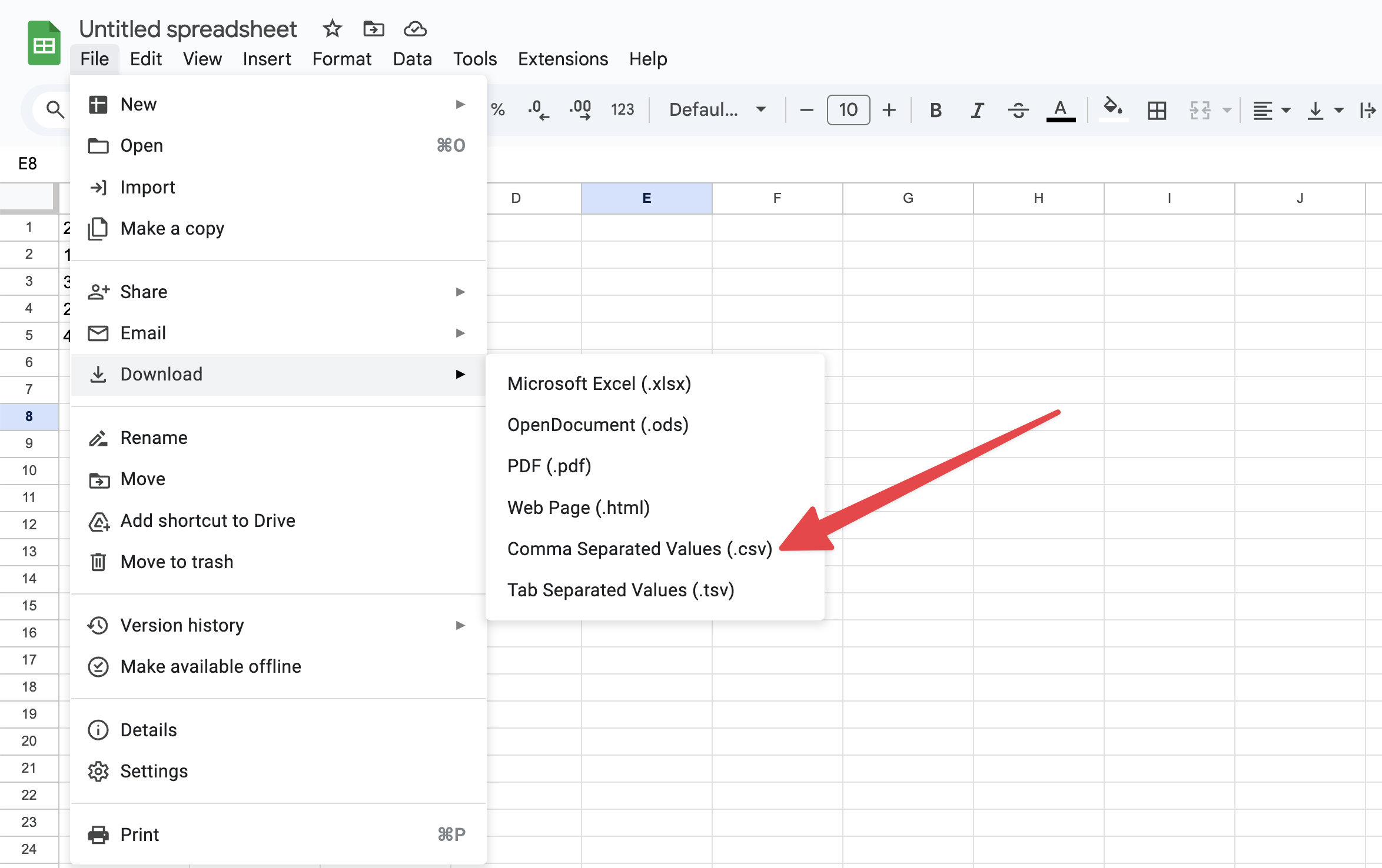
To export Google Sheets data as a CSV file, open your Google Spreadsheet in Google Docs, go to File > Download, and select Comma-separated values (.csv). This will save your Google Sheets data in the CSV format for easy use in other applications.

Export Microsoft Excel Spreadsheets
To export an Excel file as a CSV, open your Microsoft Excel document, go to File > Save As, and choose CSV (Comma delimited) (*.csv) from the file type options. This will save your Excel data in CSV format for easy use in other applications.

Need a more powerful tool?
If you’re looking to create an interactive map, consider using a tool like Atlist. It offers a variety of powerful features, including:
- Clickable Markers: Your location data is plotted as markers, and when markers are clicked, they open a detailed pop-up modal with additional information.
- Advanced Spreadsheet Uploading: Upload far more columns in your spreadsheet data.
- Custom Styling: Fully customize the appearance of markers and modals. Choose between hundreds of map style templates.
- Advanced Search & Filtering: Enable powerful search options and filter by tags for easy navigation.
- Easy Embedding: Seamlessly embed your custom maps on any website.
- Custom Design Options: Personalize every aspect of your maps to match your brand or aesthetic.
- CTA Integration: Add call-to-action buttons directly to your maps.
.png)
FAQ
Does this tool support longitude and latitude?
Not at this time. You can use a tool like Atlist for uploading location data with longitude coordinates.
Do I need a Google Account for this tool?
No. We provide the Google Maps API so you do not need a Google Account.
Support
Got feedback or suggestions? We’d love to hear from you! Email steve@atlist.com.

